
Dalmally Horseshoe
Distance 8.5 miles
Height 3700 ft/ total ascent about 3700
Start/Parking Castles Estate gate, at Junction A85 and B8077. NN133285
Approximate time 5 -6 hours
Description
The Dalmally Horseshoe is a less demanding route than the Cruachan horseshoe and includes a small part of the Cruachan loop.
For those with the time and energy, this loop can be extended by the addition of a detour to visit Cruachan.
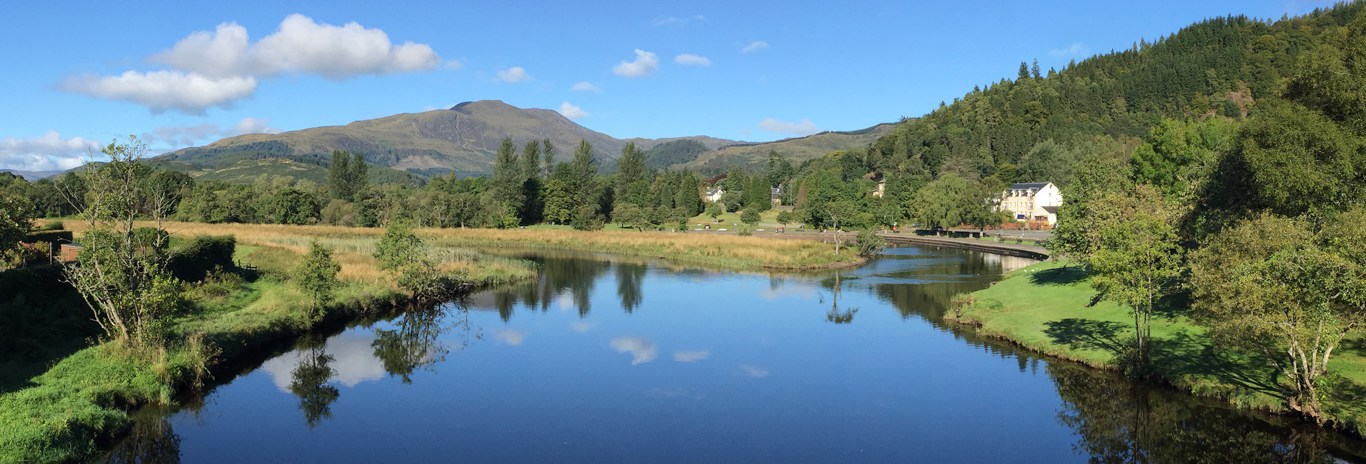
Excellent views to Loch Awe and to the peaks around Tyndrum and Glen Lochy
Park near the gate to Castles estate, but do not block the access.
Go through the gate and follow the landrover track for about ¾ mile wher you follow the wider track rising to the left and passing a quarry. Stay on this track to find a footbridge over the Allt Coire Ghlais at NN120295. Continue over unmarked soft ground, roughly 240o for about ¼ mile then start the climb up soft grassy slopes about 285o to a false summit (NN953303 - about 1.5mile). Now bear 335o to Stob Garbh true summit (NN095309) at 3200ft.
From Stob Garbh continue on about 285o for 600 yards to Stob Diamh (NN095309, 3200ft). This is the highest point of the circuit and good views are on offer down Loch Awe and to Cruachan behind Drochaid Ghlas.
For the fit - an extended walk can be had by visiting the peak of Cruachan by heading 250o and following the ridge for about 1½ miles to the summit then return to Stob Diamh. This adds 3 miles to the circuit and requires a little scrambling skill to cross some difficult slabs (a 'granny stopper') just before the summit.
Otherwise - head 55o down an easy scramble (care required in icy conditions) to a bealach before an easy walk up to Sron an Isean (NN010312, 3120ft).
From Sron an Isean be careful not to take the north ridge leading to dangerous crags. Head 90o for an easy walk down grassy slopes curving slowly round to 140o.
The track - at first obvious - slowly disappears, but after about 1½ miles take care to avoid some crags (about NN119302) by rounding them to the north. After by-passing these crags head approx 120o for about ½ mile to find a footbridge at NN128297. Follow a wet track to rejoin the original land rover track and return to the parking area.
A reminder - this route can be difficult, in winter conditions. Navigation may be tricky in poor visibility.
Height 3700 ft/ total ascent about 3700
Start/Parking Castles Estate gate, at Junction A85 and B8077. NN133285
Approximate time 5 -6 hours
Description
The Dalmally Horseshoe is a less demanding route than the Cruachan horseshoe and includes a small part of the Cruachan loop.
For those with the time and energy, this loop can be extended by the addition of a detour to visit Cruachan.
Excellent views to Loch Awe and to the peaks around Tyndrum and Glen Lochy
Directions
Park near the gate to Castles estate, but do not block the access.
Go through the gate and follow the landrover track for about ¾ mile wher you follow the wider track rising to the left and passing a quarry. Stay on this track to find a footbridge over the Allt Coire Ghlais at NN120295. Continue over unmarked soft ground, roughly 240o for about ¼ mile then start the climb up soft grassy slopes about 285o to a false summit (NN953303 - about 1.5mile). Now bear 335o to Stob Garbh true summit (NN095309) at 3200ft.
From Stob Garbh continue on about 285o for 600 yards to Stob Diamh (NN095309, 3200ft). This is the highest point of the circuit and good views are on offer down Loch Awe and to Cruachan behind Drochaid Ghlas.
For the fit - an extended walk can be had by visiting the peak of Cruachan by heading 250o and following the ridge for about 1½ miles to the summit then return to Stob Diamh. This adds 3 miles to the circuit and requires a little scrambling skill to cross some difficult slabs (a 'granny stopper') just before the summit.
Otherwise - head 55o down an easy scramble (care required in icy conditions) to a bealach before an easy walk up to Sron an Isean (NN010312, 3120ft).
From Sron an Isean be careful not to take the north ridge leading to dangerous crags. Head 90o for an easy walk down grassy slopes curving slowly round to 140o.
The track - at first obvious - slowly disappears, but after about 1½ miles take care to avoid some crags (about NN119302) by rounding them to the north. After by-passing these crags head approx 120o for about ½ mile to find a footbridge at NN128297. Follow a wet track to rejoin the original land rover track and return to the parking area.
A reminder - this route can be difficult, in winter conditions. Navigation may be tricky in poor visibility.