
Auchenlaich And Bracklinn
Length: About 4 miles.
Start: East end of Callander Main Street.
This is a fairly easy walk with gentle slopes (and about 40 steps).
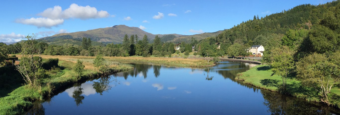
Walk toward Stirling for about 300 yards and look for some ornate wrought iron gates on the right hand side. Just beyond those gates is a pathway leading to the 'Roman Camp' - take this path to emerge onto a winding mound surmounted by a pathway through the trees.
The mound is an esker - glacial debris from the last ice age. Follow the path along the mound until you reach the river then left through a gate. Follow the river downstream for about 100 yards to an opening on the left at the far end of a field
Now comes the only mildly unpleasant part of this walk - past some workshops, the council depot and past the sewage works (don't worry, it is only for 200 yards). Turn left to pass by the workshops and council depot and reach a tarmac road which you follow to the main road.
Cross the main road to find a footpath by the burn heading up the slope behind some houses and after about 200 yards reach a surfaced footpath. Turn right here.
Now follow the surfaced footpath past the wooded area - this is the 'Auchenlaich Morraine' - another remnant of the last ice age. The path now drops to pass left of a landscaped pond and then heads up a slight slope past Auchenlaich farmhouse and behind the caravan site.
After passing the farm buildings you will see a long low mound through which the path cuts. This is the Auchenlaich Long Barrow, a partially excavated pre-historic burial mound and the longest of its kind in the country. Continuing on this path (now rough gravelled) take a sharp left turn then climb gently through trees. (A faint track exits right just after a wooded banking - this leads to the remains of a neolithic hill fort).
Ignoring a tempting left turn and continuing on the main path, a turning area is reached where your route continues as a grassy track with forestry on the left and a fence on the right. Don't be tempted by the sound of water on the right - the slopes are steep and slippery.
Follow the grass track, veering left then right to reach another T junction with another pathway. A right turn here leads down some steep steps to Bracklinn falls. A visit to the falls will require you to return here to the T junction.
Left at the T junction leads past a wooded area to the Bracklinn falls carpark. Turn left at the road to walk down the hill avoiding all side roads to return to the starting point.
Start: East end of Callander Main Street.
This is a fairly easy walk with gentle slopes (and about 40 steps).
Walk toward Stirling for about 300 yards and look for some ornate wrought iron gates on the right hand side. Just beyond those gates is a pathway leading to the 'Roman Camp' - take this path to emerge onto a winding mound surmounted by a pathway through the trees.
The mound is an esker - glacial debris from the last ice age. Follow the path along the mound until you reach the river then left through a gate. Follow the river downstream for about 100 yards to an opening on the left at the far end of a field
Now comes the only mildly unpleasant part of this walk - past some workshops, the council depot and past the sewage works (don't worry, it is only for 200 yards). Turn left to pass by the workshops and council depot and reach a tarmac road which you follow to the main road.
Cross the main road to find a footpath by the burn heading up the slope behind some houses and after about 200 yards reach a surfaced footpath. Turn right here.
Now follow the surfaced footpath past the wooded area - this is the 'Auchenlaich Morraine' - another remnant of the last ice age. The path now drops to pass left of a landscaped pond and then heads up a slight slope past Auchenlaich farmhouse and behind the caravan site.
After passing the farm buildings you will see a long low mound through which the path cuts. This is the Auchenlaich Long Barrow, a partially excavated pre-historic burial mound and the longest of its kind in the country. Continuing on this path (now rough gravelled) take a sharp left turn then climb gently through trees. (A faint track exits right just after a wooded banking - this leads to the remains of a neolithic hill fort).
Ignoring a tempting left turn and continuing on the main path, a turning area is reached where your route continues as a grassy track with forestry on the left and a fence on the right. Don't be tempted by the sound of water on the right - the slopes are steep and slippery.
Follow the grass track, veering left then right to reach another T junction with another pathway. A right turn here leads down some steep steps to Bracklinn falls. A visit to the falls will require you to return here to the T junction.
Left at the T junction leads past a wooded area to the Bracklinn falls carpark. Turn left at the road to walk down the hill avoiding all side roads to return to the starting point.